Showing posts with label mountains. Show all posts

Sunday, August 11, 2013

Mt Melibingoy (Mt Parker) and Lake Holon (Lake Maughan), T'boli, South Cotabato: All Hail This Hike!

There were a couple of thoughts battling in my head: Do I wrap my arms around the habal-habal (motorcycle) driver or do I cling on Edgar the Eazy Traveler's long legs for dear life? I was sandwiched between the two men. We, along with the whole group's lunch packed in a box and tied under our seat, were wobbling our way to Brgy. Salacafe. The road was unforgiving.

Then I concluded, if the habal-habal were to flip over, we'll all go down with it. Fo sho.

holon2
  Pet name Pocahontas since 1995.
 
So I let my hands freely feel the rush of the wind. I swayed with every turn. Shifted my arse with every bump. Cheered with Edgar whenever our habal-habal was on the lead even though there wasn't any actual race. An hour burned easily.

Before we knew it, we were at the jump-off point.
 
holon3
Edgar insisted we get on this habal-habal. For what reason? I dunno. [Photo by Louie of Nomad Perspectives]
 
The rest of our motley crew trickled by twos aboard respective habal-habals, a few minutes in between. James of Journeying James flashed his newly acquired scratches with a wide smile when he arrived, as if he just purchased some rare novelty souvenir. Speaking of flipping motorcycles, theirs did, apparently. Shortly after we all left the municipal tourism office of T'boli.

Lunch, after being unfastened from our habal-habal, was served straight away. And we began our trek when everybody licked their styros clean.

holon4
"You look like you're not wearing shorts." Yoshke of The Poor Traveler commented as he snapped this photo. I smiled in between huffs.
 
Our guide and overseer for the trek (make that, for the entire trip), Louie of Nomad Perspectives, led the way. Not only is he a fellow travel blogger, he also works for Allah Valley Landscape Development Alliance (funded by LGSP-LED) who invited us for the familiarization tour. He has trudged the trail a ridiculous amount of times, which made him the perfect person for the task.

melibingoy
Climbing Mt. Melibingoy, also known as Mt. Parker. [Photo by Edgar of Eazy Traveler]

Mt. Melibingoy also called Mt. Parker (after an American General named Frank Parker who claimed to have discovered it), towering at about 1,750 MASL tall, is a dormant volcano. The objective of our group was not to summit its peak, but to camp at the bank of its gorgeous crater lake, Lake Holon also called Lake Maughan (after another American who was with Parker when he crashed during a survey operation).

holon6
Life on the edge. A viewpoint partially concealed from the trail, about halfway the course. Louie was gripping my flourescent-hued top while I sit and relax and take this in.

holon8
The lushest I've trekked.

The supposed two-hour trek on our itinerary was stretched to four. No, not because we ventured into further territory. But because some of us, myself included, got too preoccupied with our huffing and puffing (I must have asked "Are we there yet?" a dozen times). And well... Also because of our countless stops for pitcher plants, stick insects, wild berries, endemic flowers, tall trees and vines waiting to strangle unsuspecting trekkers.

How easily were we amused. We giggled all the way from Brgy. Salacafe through sleepy Sitio Nabol up until Kutong Busaw (1,500 MASL) the view point for Lake Holon where we laid our weary bones under the roof of an open cottage that had seen better days.

holon10
We must have spent fifteen long minutes gawking at this. So I say it again, how easily were we amused.
 
holon9
What now?! Dennis of Love Mindanao, plans his next step.

Beyond that point, it was all business for everyone. A peek at the obstructed view was a tease that drove us nuts. And so we all pushed on to the final stretch, another half-hour descent down to one of the country's cleanest bodies of water, without much procrastination. Throughout the trek, menacing gray clouds hovered above — but they remained empty threats. They merely shielded us from the sun.

The weather was more than ideal. And I called it, 'tent weather'.

holon7
One of the country's cleanest inland bodies of water.

holon12
Waking up to paradise.

The camp site was newly cleared and the scent of freshly slashed wild grass was still lingering in the air. We quickly dumped our backpacks in tents pitched for us by the support team. While the others climbed aboard wooden canoes, I sat on a rock. I watched them drift away. My mind too, drifted to far-flung places

Lake Holon reflected the sky that magically cleared.

I suddenly thought of the trek back the day after and how much more difficult it would be for me. Cause this... This is a sight that's hard to walk away from.

holon13
Because we felt like we're on a T'boli tourism brochure.

How to get to Mt. Melibingoy/Mt. Parker:

The municipality of T'boli, South Cotabato is about an hour and a half drive from General Santos City. Or forty-five minutes by public transport from Koronadal City/Marbel.

Mt Melibingoy/Mt. Parker hike can be arranged through the tourism office located near T'boli's municipal hall (just off the Surallah-T'boli Road).

Trip begins with a forty-five to one hour habal-habal (motorcycle) ride from the municipality center to the jump-off at Brgy. Salacafe. Part of the ride is on unpaved, bumpy road and weaves through banana farms.

Trek to Lake Holon/Lake Maughan via Salacafe trail takes about three to four hours. Remember to arrange for pick up the next day, it could be difficult to get a ride back.


Share

This page was viewed times.

Friday, July 19, 2013

Allah Valley Tour 2013: A Fleeting Glimpse

"Sometimes the best decisions are the ones you make in an instant with your heart rather than the ones long-debated in your mind.", I once read.

Not too long ago, more than 7,800 kilometers away, I said 'yes' to an Allah Valley Familiarization Tour email invite (from LGSP-LED and AVLDA) as if it was the marriage proposal I had been waiting for all my life. Like, I was ready to drop everything cause my gut was nagging me with the words this is the one  and I didn't even know where in the world Allah Valley was.

We were then encamped in a Yerevan Airbnb-listed apartment, and in the middle of a long backpacking trip. Next to Armenia, we had two more countries to wing, after which we were to let whim dictate the rest of our route. But since the invitation came, all the other overseas plans for July 14-19 were sacked. I was that committed.

Was it worth the change of itinerary? Heck yeah! It's a journey of epic proportions. Let me take you on a tour with these chunky fragments while I weave my sappy sentiments. For now, I simply cannot conjure the right words. I am that happily hungover.

Folks, this is the merry face of Mindanao that should be out there. On print. On the web. And in people's minds. Not that negative travel advisory.

allah1
Lake Holon. Worth the arduous trek! And I say arduous cause I'm totally unfit.
 
allah2
Top: Day 1 brekkie at Sarangani Highlands. Bottom: Pinoy Travel Bloggers on a colossal Snakes and Ladders board at Dole Philippines Kalsangi Clubhouse.
 
allah3
Top: Travel bloggers with LGSP-LED and AVLDA. Bottom: Dole Plantation, Polomolok, South Cotabato.

allah4
Top: Day 1 dinner at Aviary Bar & Restaurant of The Farm @ Carpenter Hill, Koronadal City, South Cotabato. Bottom: With multi-awarded photographer George Tapan *faints*!
 
allah5
Top: One of Surallah's attractions, made by artist Kublai Ponce Millan. Bottom: Ehek Lemsnolon Community, T'boli, South Cotabato. 
 
allah7
Top: Climbing Mt. Melibingoy (also known as Mt. Parker). Bottom: Lake Holon canoeing. So they call me Pocahontas.
 
allah6
One-hour Lake Sebu cruise over brekkie care of Mountain Lake Eco Resort.
 
allah8
Top: With T'boli dreamweaver Be Lang Dulay, a National Living Treasure. Bottom: Lake Sebu Seven Falls Zipline. In tandem with The Poor Traveler.
 
allah9
Provincial Capitol of Sultan Kudarat, Isulan, Sultan Kudarat. What. A. Looker.
 
allah10
Top: Baras Bird Sanctuary, Tacurong City, Sultan Kudarat. Photo by travelmate Eazy Traveler. Bottom: Marquez Hot And Cold Spring Resort, Esperanza, Sultan Kudarat. With We Are Sole Sisters and Journeying James.

allah11
Top: T'nalak Festival Street Parade. Bottom: T'nalak Fest cray-cray foam party!

See?! This is something I wouldn't miss for the world!

Some photos were taken by nomadperspectives.com, eazytraveler.com, and lovemindanao.com

Share

This page was viewed times.

Monday, May 14, 2012

Mt. Pulag National Park, Benguet: Mother's Day Climb

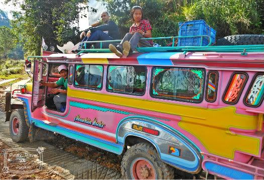
I switched stifling yawns and suppressing chuckles whilst straddled on the bench of our hired pink jeep (Yep you heard me, pink!). A more sluggish hubby donning tightish jeans was seated on the jeep's roof, the only one from our gang of eight who did so. The thought of him climbing Mt. Pulag, Luzon's highest peak, later that day in them jeans sent me to a constant snicker fit.


Postcard-worthy snapshot by the RoadWorthyMan.

You see, just twenty-two hours earlier aboard a Baguio-bound bus, he decided to join the climb which my mountaineering pal Christine organized months prior as my welcome-back-home shindig. Thanks to Baguio's ukay stores, we were able to buy him a cheap down jacket and long sleeved top. We purchased a pair of trekking shoes too, which luckily was on sale. Hubby refused to shell out more bills for new pants however, thus his biker-meets-hiker getup.


Now didn't I tell you it's pink? Hubby still beaming, midway the bumpy ride.

Our jeep just left the DENR office (where we attended a quick briefing about Mount Pulag National Park) and was literally bouncing its way on ridiculously rough road to the jump-off point, Badabak Ranger Station. Occasionally we did stops to haul another jeep following us, loaded with even more passengers. And occasionally I yelled "I don't want to be a single mom!" outside the window which the hubby took as cue to hop off the roof. He began feeling terrified anyway when his camera panned through a backdrop consisting of a cliff just below his dangling feet.


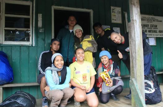
Badabak Ranger Station, before things got dirrrty. Photo from Izah's cam, taken by our guide Ditas.

The usual one hour drive from the DENR office to the ranger station took almost two. We were all bushed when we stepped out of the jeep. I immediately felt a familiar light-headedness, caused by the thin air. Prolly by lack of sleep too. Our motley crew that was composed of me, the hubby, Christine, Olay, Izah and boyf Joseph (Who baked kickass choco chip cookies for us!), Marky and Erick groggily gobbled our takeaway lunch at the ranger station's front porch before pushing on.

Pulag
Female porters made the hike look easy, breezy. Made me look like a weakling too. Pfft.

The impending downpour pumped up our supposedly "chillax" pace (Ambangeg trail may be the easiest way to Mt. Pulag's peak, but it sure ain't something I'd call "chillax"!). We didn't want to exhaust ourselves more than necessary, but we certainly didn't want to pitch our tent under the rain. I huffed and puffed my way to Camp 2, and during our breaks I longed for a porter but a better part of me said "Heck no!". For the last two hundred meters, hubby sprinted to the camping area to start pitching the tent. He left me to my thoughts. The others were far behind and I trekked alone.

pulag4
Post speed-pitching. Pre debate about where the tent door must face (This is why we haven't seriously considered buying a house yet.).

In that solitude, my adventure flame was reignited. This flame died for the nth time months ago, which coincided with that burnt-out after effect only a round-the-world trip with a toddler could induce. With a sudden surge of renewed energy, I hiked with ease the last few meters of gradual ascent to Camp 2, where Marky and the hubby were already pitching tents. Or at least, trying to. Both required extra hands, non-frozen ones, dexterous enough to work them poles and pegs.

pulag7
Breaking dawn.

Those hands arrived almost half an hour after. And our overnight climber's commune was setup in just fifteen minutes. Before the rain poured, we were able to quickly cook dinner. Dinner at 3:00 PM. "Lights out" (More aptly called "when brains conked") followed at 4. The dreaded, infamous frigorific climate enveloped the camp just before twilight.

pulag9
En route to Mt. Pulag's highest peak.

At 2:30 AM the next day, one by one we emerged from our respective tents. Every step was a battle. I couldn't feel my fingers. I couldn't feel my nose. Despite all that, hubby's jeans still made me chuckle. And everyone's Mother's Day greeting left a smile on my numb face (Was I really smiling?). After a light brekkie, we hiked the final one-hour leg to the peak. One hour of trudging on mud and in near-total darkness. Halfway the trek, Erick played the most awesome scoring for that morn, Lovely Day. "Then I look at you (Mt. Pulag), and the world's alright with me. Just one look at you and I know it's gonna be a lovely day...", that is of course until we did the equally challenging descent.

pulag8
This backpacker mum still got it, we survived Mt. Pulag!

Atop Mt. Pulag's Peak 1 I held the hubby's hand. Throughout the trip, it was the time I felt most thrilled that he's with us. My second Mother's Day was even more insane than the first one that involved caressing a Burmese Python. This mum's definitely not the kind who hits the spa on special occasion (Unless someone else pays for it. And my hubby's not the type who does.). I still got that oomph. Why did I ever doubt myself?

pulag10
I am but a speck.

Though the sea of clouds was a no show, I remained a happy camper. Summitting Luzon's highest peak in itself is a feat I will proudly share with our daughter Luna in the future (With priceless photos of her baba hiking in jeans to back up my story). On the way back to our camp, Luna's giggles echoed in my head (A.K.A. becoming delusional.). I couldn't wait to be reunited with her in Baguio later that day. Ugh, I'm such a mum.


This page was viewed times.
Wednesday, April 18, 2012

The Three Sisters, Blue Mountains, Australia: Pre-Birthday Hiking Shindig

I've lost that adventure feeling on a multitude of occasions during our round-the-world trip. It mostly occurred when we're shacked somewhere for a significant period of time. Especially in the course of winter. Such is the case whilst we were couchsurfing (or make that bedsurfing) in my mum-in-law's Sydney home. The hubby's visa application for U.S., the next country on our list, took forever. And we chose to let our arses stay put for we were unwilling to burn our funds on pricey Oz road trips.

We became slothful and stagnant.

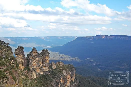
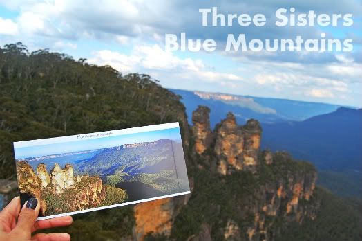
The Three Sisters rock formation.

So to reignite the adventure flame, we plotted a two-day jaunt in New South Wales' Blue Mountains, a region famous for breathtaking highland vistas and scenic bushwalk trails. A vast part of it, the Greater Blue Mountains area, is a World Heritage Site. Inscribed so for the "outstanding universal value" of its eucalypt vegetation. It had been the home of the Gundangara people for several millenia.

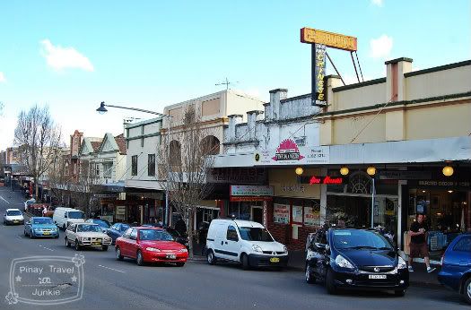
Organic cafes and thrift shops lined up along Katoomba Street, Katoomba.

The main town where tourists usually start off their respective walkabouts is Katoomba, just an hour and a half drive from Sydney via private vehicle (a couple of hours by train). Despite its proximity to our hood, we opted for an overnight getaway instead of a quickie day trip. It was one of our rare splurge events. Like, yah know, my birthday. After a not-so-big-plus-terrifying-three-oh the previous year (I was then counting down the days 'til the delivery of our daughter), the hubby granted my wish to see Blue Mountains on day 71 of our family vagabonding.

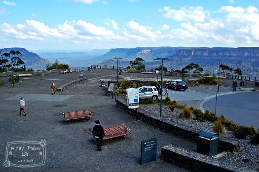
Echo Point lookout.

At about two in the afternoon, we arrived at our booked accommodation, Katoomba Mountain Lodge. A beat up, borrowed car we named Gumby brought us there without any hassle. After checking in, we merely dumped our luggage in the cozy double room assigned to us then headed out for late lunch. Because it was my call, we had Chinese.

blue11
Paved trail to the Three Sisters.

With only a few hours left of sunshine, we hurriedly left our unfinished meals at a place called Three Sisters B.B.Q. Restaurant, and drove to Echo Point lookout under the direction of our moody yet trusty GPS device. It wasn't as packed as we expected, and searching for a nearby parking space didn't take long. We spent no time idling. We strode towards the lookout platform and skirted it for an unobstructed view of Jamison Valley.

blue14
Arch at the top of the Giant Stairway.

The postcardesque scene of a massive blue haze enveloping the sandstone plateaus made my heart... Cheesiness ahead... Skip a beat. Yes folks, it's called Blue Mountains for a very obvious reason. Its blue tinge is an outcome of mie scattering - an explanation of which may bore you out of your wits but just to give you an idea, it's got something to do with ultraviolet radiation and the abundancy of eucalypt trees in the area.

blue12
Giant Stairway steep descent.

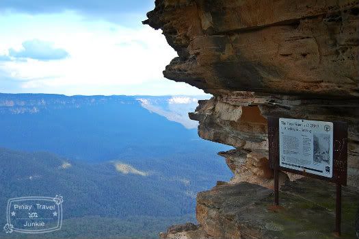
It's a dream of mine to do bushwalking along Federal Pass, a trail on the base of the cliffs in the valley. Unfortunately, it was not the right time to fulfill such dream for we were lugging our eleven-month old crawler. So we decided to just do an easy hike to the Three Sister rock formation. From the lookout, we walked to the Information Centre and followed a paved path that led us to the arch atop the Giant Stairway. A sign bears a warning: VERY STEEP - STRONG WALKERS ONLY.

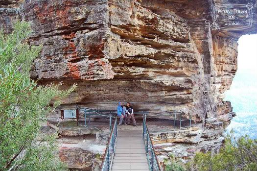
The only accessible sister.

Mind you, it ain't a joke. The stairway is insanely steep and dizzying. We reached one of the Three Sisters unscathed and were greeted by fellow hiking parents with two kids in tow, one of whom is tucked in a baby carrier. The mum happily offered to take a snapshot of us. After which they descended further and never returned. I wondered if they pushed on to accomplish the Federal Pass trek. You see, we aren't the only crazy 'rents on Earth.

Sorry adventure junkies, climbing and abseiling are not allowed.

Legend has it that three sisters of the Katoomba tribe were turned into stone by an elder to protect them from being captured by the three men of a neighboring tribe whom they fell in love with. Marriage between them was forbidden. Slumped on the bench, I thought, such dreary story behind a stunning rock formation.

The iconic Three Sisters is just one of the main attractions of Blue Mountains. And our hike that day's just half of my awesome birthday shindig. The next day on my actual 31st, we rode the steepest incline railway in the world and visited a toy with a vast collection of Barbie dolls (faint!). Now didn't I say it was awesome?

Share


This page was viewed times.
Saturday, September 10, 2011

Snapshot Saturday: Postcard #4 Blue Mountains, New South Wales


It's day 81 of our our round-the-world trip (already?!), and this morning we'll finally leave Sydney. We've had enough of the cold (plus Shervin's visa for America is taking forever) and just a few days ago we decided to head north. To Byron awesome Bay! We'll be in transit for the next two days and I can't wait to see the artsy, hippie house we're renting for six weeks near the beach.

More on that later.

Meanwhile, the next postcard for the The Postard Project was bought from Katoomba Visitor Information Centre at Echo Point, the main lookout for the Three Sisters in Blue Mountains National Park. Because I spent my birthday there last weekend, the postcard I got is ahem, more than the usual.

It's not too late to join! Email your address to gaye.emami@yahoo.com. Recipients are chosen via Random.org.


Share


This page was viewed times.
Saturday, September 3, 2011

Snapshot Saturday: Blue Birthday

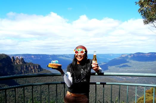
Eagle Hawk Lookout, Blue Mountains, NSW Australia. Behind me, the famous Three Sisters rock formation (left) and Jamison Valley.

I was devouring every dish from the buffet spread, and appeared elated to the small group of merry people on our round table. I was about twenty pounds above my normal weight yet my massiveness was the least of my concerns. In my head, I was trying hard to brush off a horrific thought.

The thought that I may give birth anytime bugged me heaps even though the Chinese restaurant where we had my birthday lunch is just a few meters away from the hospital. It was my 30th by the way, and that was definitely not how I envisioned my big three-O to be... Celebrating with pregnancy blues.

Yesterday, to make up for that doleful event last year, I partied like 31 is the new 21 (and by "partied" I mean chugged, then bushwalked until we were bushed). From one blue birthday to another: Pregnancy blues last year, Blue Mountains (Australia) birthday this year - Now ain't that cool?

Share


This page was viewed times.


Tuesday, July 26, 2011

Mt. Cabuyao, Benguet: Into the Clouds

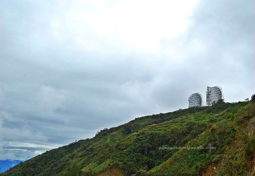
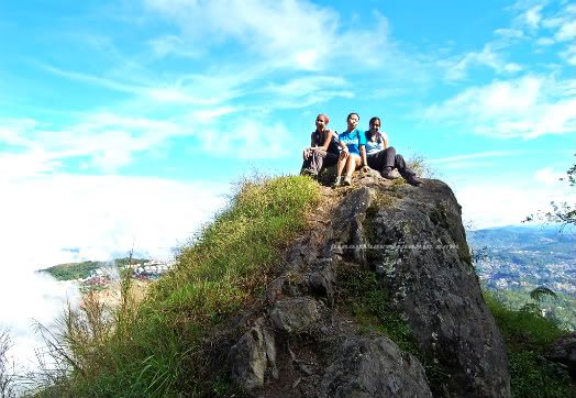
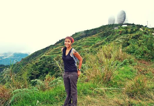
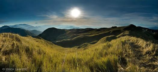
Not quite Mt. Pulag. But like other mountains in the Cordillera Region of the Philippines, Mt. Cabuyao at 2,025 meters above sea level, is almost constantly engulfed in a sea of clouds even on a clear summer day. Its renowned two discs called 'radar' by locals perched atop the peak, though gargantuan, could easily hide out of sight.

Approaching Mt. Cabuyao's peak.

It was the last week of January this year, I shivered as I walked up and down Session Road at six in the morn. Baguio was experiencing one of its coldest months of all time. The lowest temperature recorded that month was a freezing 9.6 degrees centigrade.

Amidst the darkness of dawn, I caught a glimpse of three figures strolling my way. It didn't take long for me to recognize who they were. Hearing one woman's boisterous laughter was enough for me to know.

I met up with my old mountaineering buddies. There's Christine of the Jovial Wanderer, Tristan, and his girlfriend Morena who I met for the first time. The previous night, the three just arrived in Baguio from Sagada. My family have been living in the city for almost three months already, but have not been outdoors much. So when I received their invite for a climb, even with a toe nail that completely chipped off which left me limping, I blurted a resounding yes.

Climbing Pinays rock! Me, Christine, and Morena. Somewhere off the paved trail.

We were soon on our way to the jump off point after a quick brekkie at Pizza Volante, one of the few food joints that's open early in the morn. It only took us one jeep ride to get to Green Valley from the city proper. The driver dropped us off at the end of his route.

I tied the knot of my handicapped toe's makeshift cast made of mesh ribbon tighter in preparation for the hike. It sure is a minor climb, but even walking on flat ground was burdensome for me. I was armed with a liter of water and an expectation that I could bum off trail food from the person who's got a stockpile of it, *cough* Christine *cough*. And so, we began our hike.

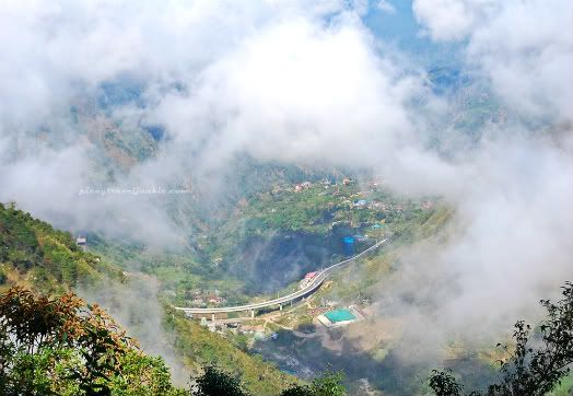
Bird's eye view of Marcos Highway.

Our pace was snail speed. No one was in a rush. It's been almost a year and a month since my last gruesome trek. I was then two months pregnant, and with the encouragement of my bacpacking-partner-slash-hubby I braved the seven falls of Mambukal in Murcia, Bacolod City.

So it's been a while. A very long while since I conquered a mountain. A very long while since I had that empowering feeling that can only be attained through summiting peaks. I relished every step. For every step represented a temporal freedom from the insane abyss of motherhood. And every step symbolized the courage to hold on to my individual self. Yes I am a mom, but I am also a mountaineer.

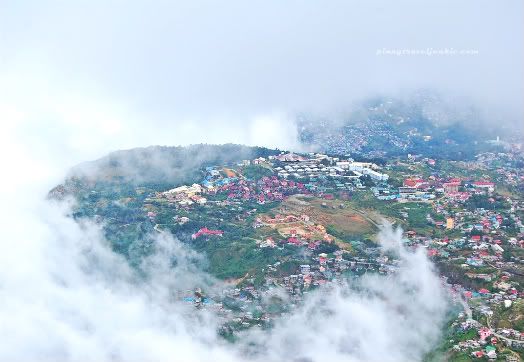
Benguet, into the clouds.

Though these random, abstruse thoughts were running in my head, I was merrily catching up with the group. And eating Christine's food. Being with them always makes me feel alive. Our hike (about 5 kilometers) lasted for almost two hours, snail speed remember? We intended to reach Mt. Sto. Tomas, the highest point in Baguio. But because of laziness a misunderstanding with locals (they told us we're already in Sto. Tomas, referring to the baranggay not the mountain) and dark clouds approaching, we all agreed to hike back once we have reached the two radio transmitters. We couldn't risk getting stuck up there in the rain for they were heading to Manila in the afternoon.

Plus, my hubby and then 4-month old infant (who was low on milk!) were locked out of the house and I had the keys. They waited for almost five hours for me to come home. The hubby's first words when I arrived, "Did you enjoy your climb?".

The backpacker mum savoring an infant-free morning.

Trip's Nitty Gritty:

1. How to get to Mt. Cabuyao/Mt. Sto. Tomas jump off: Jeeps to Green Valley at the time of our trip were parked along Shagem Street, between the streets of Abanao and Otek. Fare was about P15. Takes a while for the jeep to get packed.

2. Drive from Baguio City proper to Green Valley's about half an hour. Driver will drop you off at the end part of the jeep's route. Just follow the ascending paved road.

3. There's no admission fee collected.

4. If you feel like hitching a ride going down, there are few vehicles that do pass, mostly trucks or jeeps transporting newly harvested veggies.

5. Jeeps heading back to the city proper from the jump off point are rare. Ask for the schedule. Cabs are a few as well.


Share


This page was viewed times.

Thursday, September 9, 2010

A Climb With John

Because I have loved life, I shall have no sorrow to die.
- Amelia Burr
It was 2007. Because of an unexpected approved vacation leave, I was able to join a climb with All Terrain Mountaineering Club (ATMC). Straight from a graveyard shift (I too, was a call center agent in my past life), I headed to Jam's station along Taft Ave. to meet up with the group. And that's where I met John.

Gulugod Baboy, named so because of the peak's contour. Photo by Jhe Cruzana.

Friday, January 22, 2010

A Hike Up Victoria Peak

We didn't make any plans for our third day in Hong Kong but to buy train tickets to Beijing, so we slept until 10:00 AM. I was awoken by my sister's text message that said she's home safe. Actually earlier that morning, around 5-ish, we got up briefly to hail a cab that will take my sister to Central Station. And from there, she'll transfer to the Airport Express Line. She was in deep melancholy when she left, and she hated me for booking her flight back to the Philippines that early.

Victoria Peak's The Peak

I rose from our sleeping bag-turned-bed and went to the kitchen to prepare coffee. We were staying at my husband's ex-colleague Will's pad. I could feel my joints aching, strained from our hectic tour the day before. I was hoping for a relaxed day, but when Will got out of his room and invited us to visit The Peak, I wasn't able to resist. It was our last day in Hong Kong anyway, so we better make the most of it.

Though my hamstrings were still complaining, I braved our short hike up Victoria Peak. Yes, we did not take public transport. We entered the hilly property of The University of Hong Kong (just across Will's building), exited at a back gate, and followed an ascending narrow road. Just about 20 minutes into the hike, we ended up on the 'Morning Trail'. In that area, traffic noise is already filtered by a heavy population of trees. The only other sound I could hear was Will talking to Shervin about how he mastered Lao dancing in Laos (I was walking way behind them).

The Morning Trail is popular not only to local joggers, but also to Tai Chi practitioners because the trail branches out into uncrowded pocket parks.

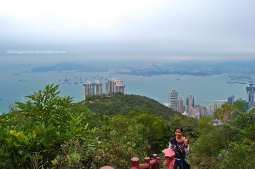
Halfway to the peak.

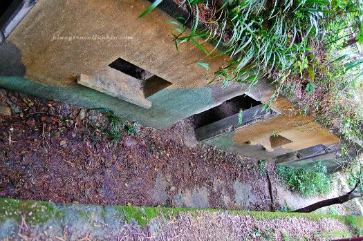
Somewhere along the way we entered Lung Fu Shan Country Park, the smallest country park in Hong Kong. Pinewood Battery (an old defense line completed in 1905) and Pinewood Garden picnic site can be found here.

Bunkers constructed at Pinewood Battery.

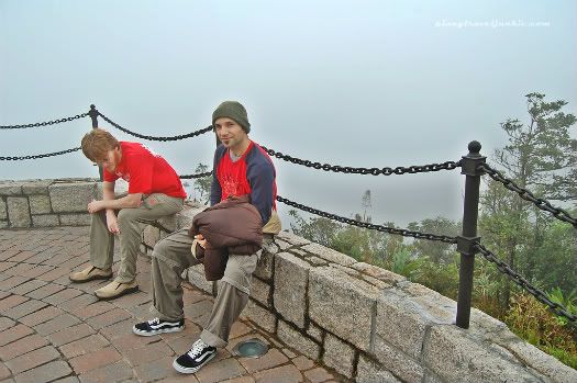
Then finally, we trudged on 'The Governor's Walk' which led us to the view point. When we arrived, the air was dense with the fog's penetration, we couldn't see anything beyond a 5-meter radius.

View point, zero visibility. What now?

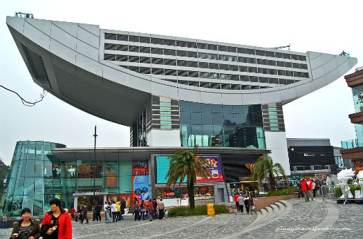
Where we were ain't The Peak yet. To avoid confusion, Victoria Peak is the highest mountain in Hong Kong Island. It is also known as Mount Austin or simply The Peak. On top of Victoria Peak are The Peak Tram, The Peak Tower and The Peak Galleria, which at times are also called The Peak. Okay, so it's still kind of confusing.

But anyway, moving forward, we walked (at last after a 2-hour hike) to The Peak Tower where we will be catching The Peak Tram. It's already hazy how we got there, I just kept following Will. For you guys who will be heading to The Peak from the MTR station, here are two easy ways to get there on foot (plus other sites along the way!):

1. From MTR Central Station, exit J2. Turn right through Chater Garden to Garden Road. Keep walking until you see St. John's Cathedral (oldest surviving Western ecclesiastical building in Hong King) on your right, just a few more meters should be The Peak Tram's Lower Terminus to your left.

2. From Admiralty Station, exit C1 and follow signs to 'Hong Kong Park' or 'Island Shangri-La Hotel'. You'll be passing by Flagstaff House (Museum of Tea Ware), the oldest existing Western building in Hong Kong. Follow the signs to Rawlinson House (old residence of the Deputy Commander of the British Forces in the old Victoria Barracks). Walk up along Cotton Tree Drive, then turn right to the Peak Tram's Lower Terminus when you pass by the Hong Kong Squash Center.

For more information about The Peak Tram, check out their website. Its history, hours of operation, promos, and a whole lot more are discussed in detail there.

Recommended: Climb up The Sky Terrace on top of The Peak Tower! A 360° view of Hong Kong Island awaits.

Octopus Cards can be used to pay for the tram's ticket. Mine was already out of credits so I paid in cash, HK$22 one way. This was December 2009. Just last 1 January 2010, price was raised to HK$25.

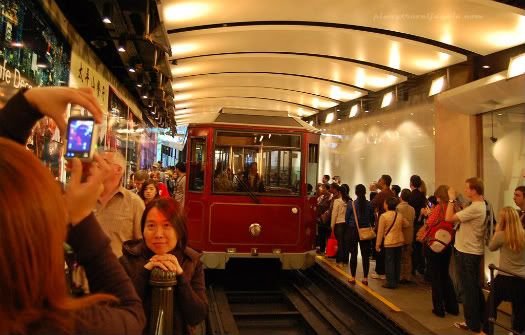
At the Peak Tram's Lower Terminus.

It took a while before the next tram arrived. The trip itself however, only takes about 5 minutes from end to end. At The Peak's Lower Terminus by the way is where Madame Tussauds is located. Though their exhibit is different from Amsterdam's (which I was able to visit in 2007), I refused to check it out. It would have been nice to have a photo with Jackie Chan, perhaps I'll have that chance next time. The HK$160 ticket was just too much.

For more information on Madame Tussauds Hong Kong, here's their website.

It was already 2:00 PM. We left the terminus and strolled across Hong Kong Park towards Admiralty Station. Will was going to accompany us to Hung Hom Station next so we can buy our tickets to Beijing.

Share


This page was viewed times.
Related Posts Plugin for WordPress, Blogger...